North Cascades National Park
The Ascent
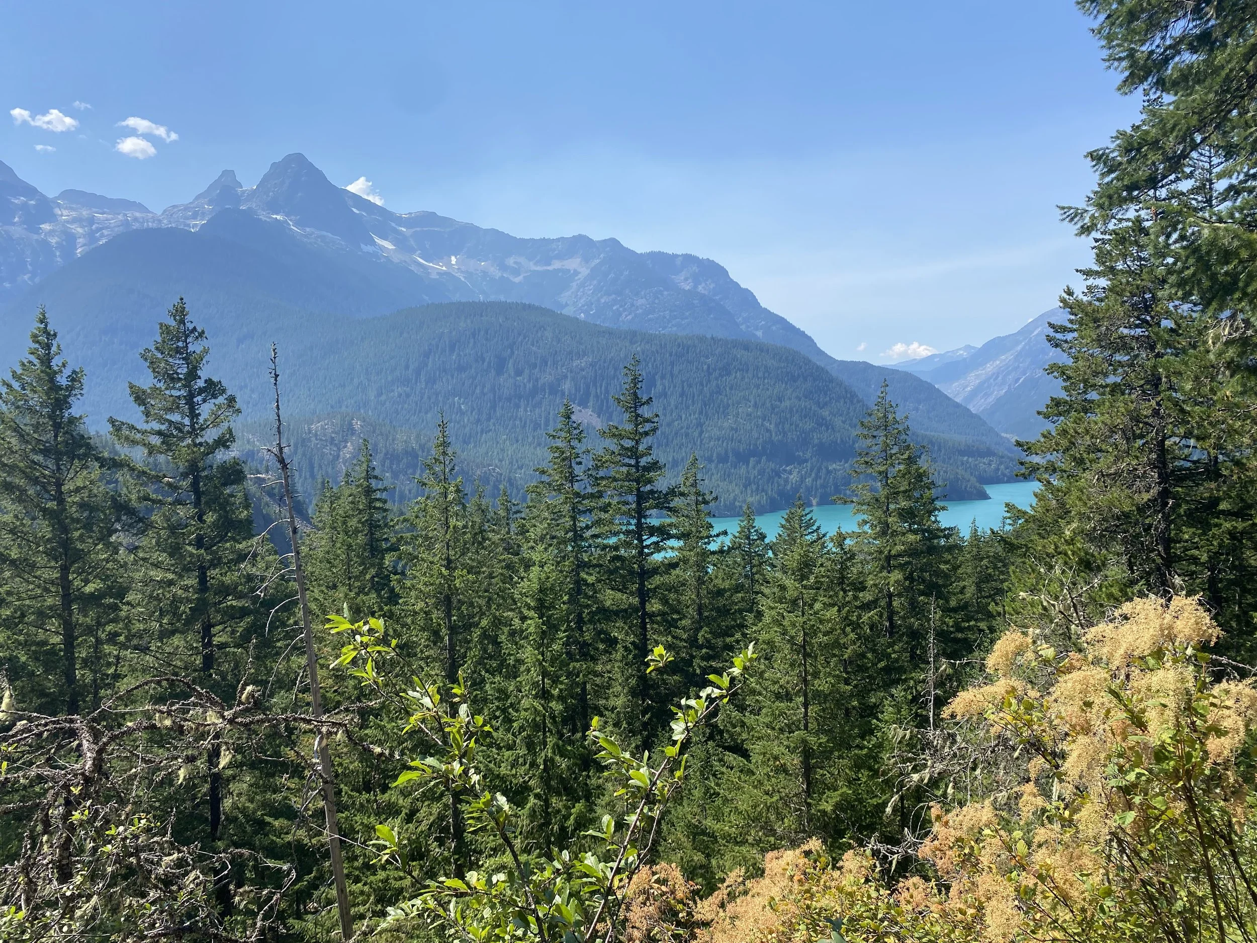
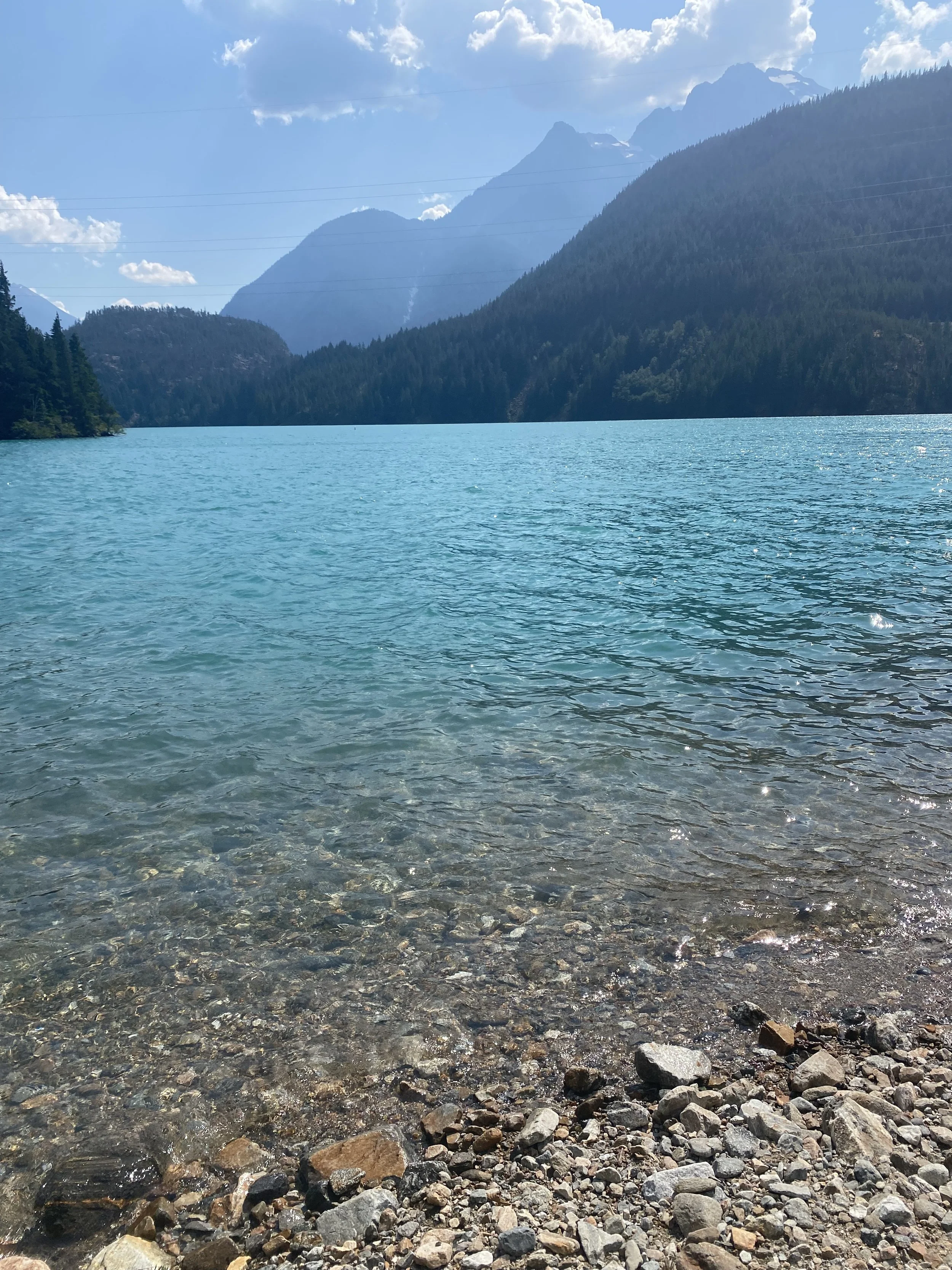
View from the trail while hiking up to the Ross Lake Dam in the North Cascades. This area contains three dams -- Gorge, Diablo, and Ross -- which supply about 20% of power for the Seattle metropolitan area.
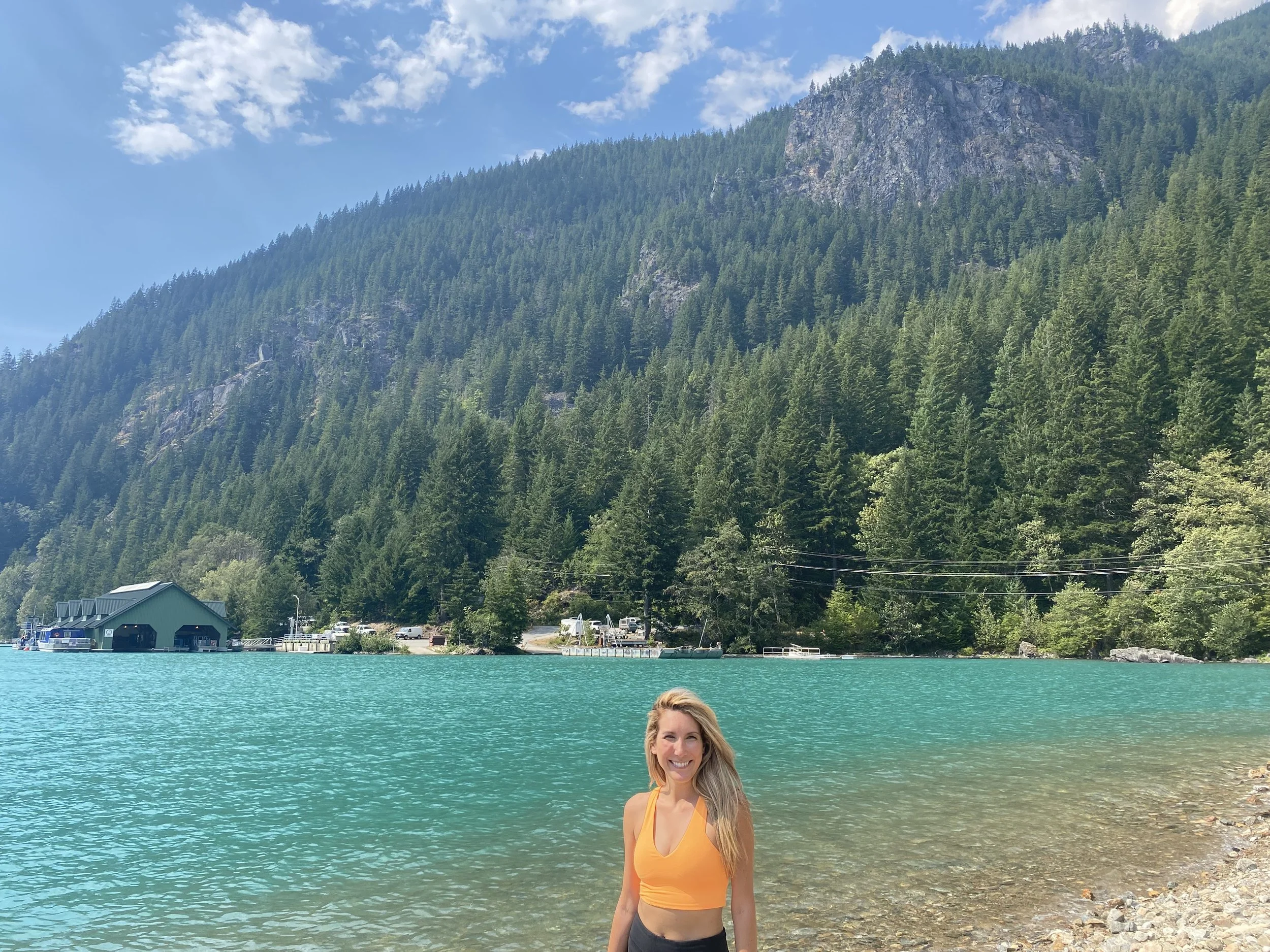
These dams harness power from the Skagit and form a chain of emerald green lakes that bear their names. While overlooking Diablo Lake, we hiked to Ross Dam.
Ross Lake is above the dam and extends twenty three miles into British Columbia. Constructed in 1949, it was 540 feet high and 1,300 feet long. In 1954, it flooded 500 acres into British Columbia and Seattle City Light paid the Canadian government $250,000 as well as a $5,000 annuity. The lump sum is equivalent to about $3MM today.
In the 1970’s the city of Seattle wanted to raise the dam, which would have flooded portions of the North Cascades and parts of British Columbia. The Canadians and the City reached an agreement that Seattle would purchase an equivalent amount of power from British Columbia who would supply it. In 1968, North Cascades National Park was established.
The National Park service was unsure about their position regarding the flooding of the dam initially. On one hand, they saw that caring for reservoirs ensured their place in the government. However, the impact to the land was undeniable and widely against popular opinion. It is incredible over its 109 year history the way the NPS has evolved.
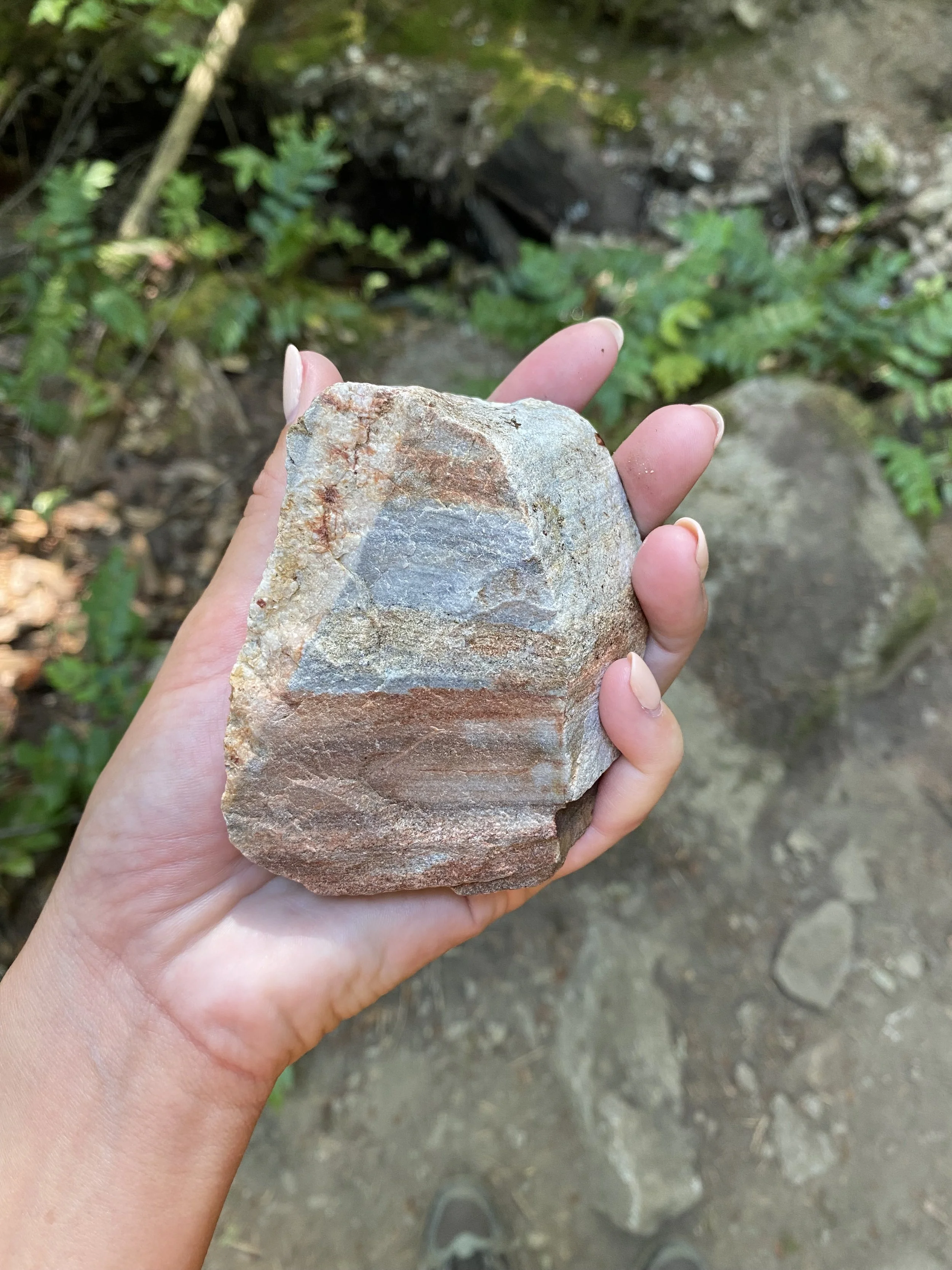
Rock Formations
The geology of the area was present while we were hiking. Various formations lined our path, beautiful colors contained in the sedentary rocks.
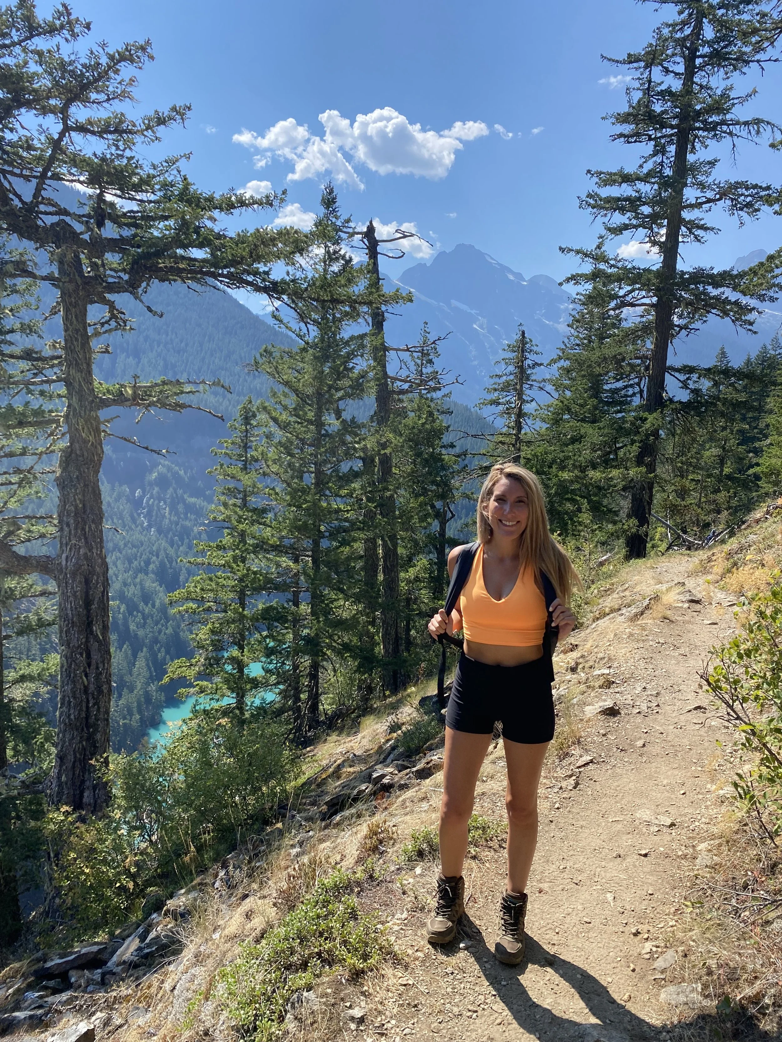
From the trail
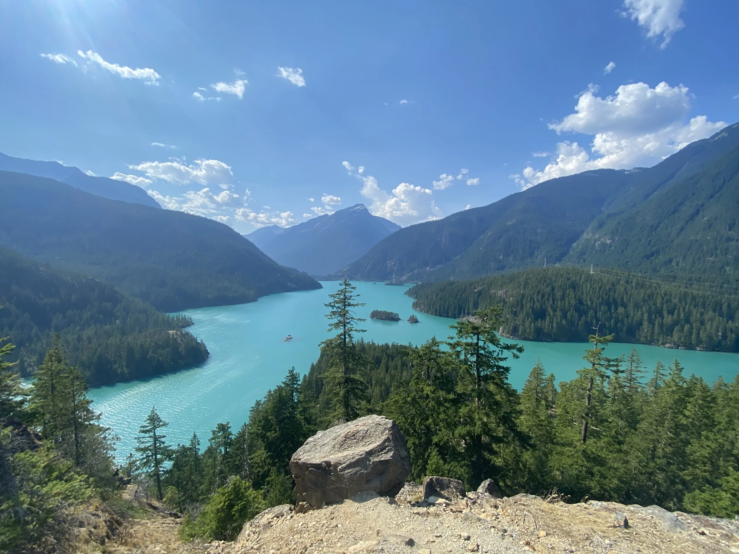
Overlooking Diablo Lake, the sun shinning brightly and upwards of 90 degrees while hiking. North Cascades, known for having a “sea of peaks”, is shown in the distance. From the NPS: “The mountain building process here was extremely complex, forming a series of seemingly unending peaks and troughs of deep, steep-sided valleys. These deep valleys, many of them carved out by glaciers, give the surrounding mountains an immensely dramatic relief, making them appear higher than they really are. Though not many peaks are above 9,000 feet, they rise above valley floors that are mostly under an elevation of 2,000 feet.”

Tap on the right for more photos
According to the NPS “Washington's North Cascades rank as some of the country's wildest, most rugged, and beautiful mountains outside of Alaska. More importantly, perhaps, the North Cascades were considered "true wilderness." In the middle of the twentieth century, they were known mostly to mountaineers, and before that by a relative handful of explorers, miners, loggers, settlers, dam builders, and, of course, the Skagit peoples. The range's deep, glaciated valleys and jumble of precipitous, glacier-clad peaks formed a nearly impenetrable barrier to human progress. When it was officially opened in 1972, State Highway 20 was the first and only east-west road to cross the formidable country north of Stevens Pass.” This pass is often still inaccessible from mid November - April.